
One intrepid trekker explores a patchwork of local preserves with a motley crew of companions
By David Claude Bailey
Does it surprise you that Guilford County has 10 “passive” parks, covering thousands of acres with hundreds of miles of trails? Who knew? Not me. But during our COVID winter, I began exploring what are, in my opinion, Guilford’s most unappreciated parks, each one an incredible sanctum of serenity. Largely undeveloped with low-impact trails, they are sometimes called preserves. How, you ask, did we get so lucky? Decades ago, Guilford’s decision-makers realized that an area’s quality of life is directly connected to how much open space is set aside to balance congestion and urban sprawl. Consequently, they decided to spend tens of millions of dollars to keep the green in Greensboro — and High Point and the rest of the county. It was nothing short of prescient. Now protected are open areas offering habitat for wild critters, historical sites, places for groundwater to recharge, plus acres and acres of tall trees and lush plants that gobble up carbon dioxide and discharge oxygen, all while boosting city-dwellers’ quality of life. The bonanza for hikers — and those of us addicted to nature — are meandering streams, breathtaking vistas, wildlife encounters and, for me, the peace that passeth all understanding. Go. Find your own peace and beauty. But, first, be sure to check Guilford County’s Passive Parks website to make sure they’re open: www.guilfordcountync.gov/our-county/county-parks/passive-parks/
Richardson-Taylor Preserve
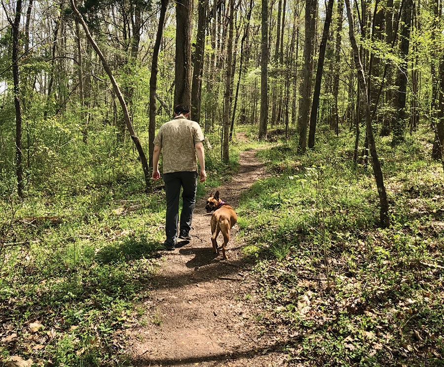
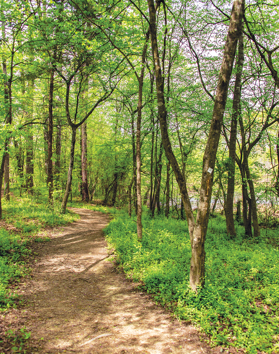
“The Durga Dog needs a romp,” my friend says, so Saturday finds us on the 3.8-mile Bill Craft Trail, which winds through the 400-plus-acre tract that the Richardson and Taylor families passed on to the county. I was meeting Durga for the first time and it turns out she has as many forms as the Hindu Goddess she’s named for. Carolina dog? Definitely. Pitbull? No doubt. German shepherd? Look at that muzzle. But watching her course her way down the meandering trail through the preserve’s remote and open woods convinces me that Durga is in touch with her inner-wolf. She carefully sniffs clusters of mushrooms that crowd the forest floor. She checks out the lush explosion of spring flora in the marshy bottomland. Almost tippy-toeing, she waltzes across the chilly creek, then bravely marches past the sign that reads “Beware of Coyotes.” One of the volunteers who helped build this trail seven years ago told me that “the forest is like an outdoor cathedral.” Surrounded by sycamores with paper-white bark and oaks that reach toward the clouds, Durga ghosts through the sunshine and shadows that fall on a bank of ferns worthy of Jurassic Park. We agree. This is Durga’s temple.
Length: 7-plus miles, out and back on the Bill Craft Trail
Difficulty: Easy and fairly level, with a few ups and downs
Don’t miss: The beavers if you can spot them
Good to know: Slippery when wet and still under remediation, as the county calls it.
Address: 350 Plainfield Road, Greensboro
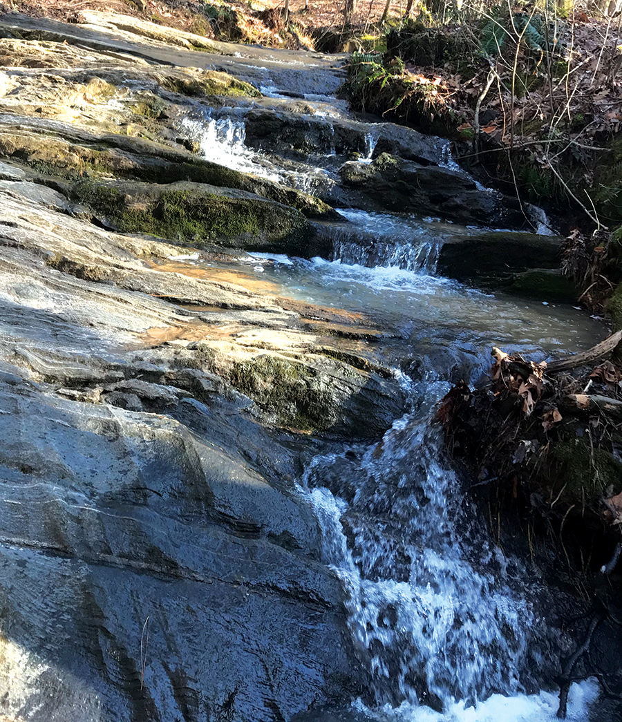
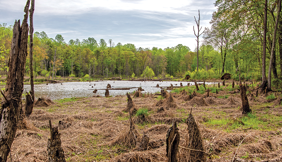
Cascades Preserve
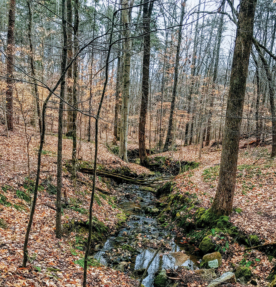
My hiking buddy, Joe, is all too ready for a walk in the woods. He splits his time between his childhood home of Greensboro and his house near the Capitol in Washington. Things have been just a little too exciting for Joe in his D.C. neighborhood of late. And so it is on a sunny afternoon that we’re trying to find the Cascades Preserve trailhead. At first, my aging GPS takes us to a Goodwill Church Road in Forsyth County. At the trailhead, it takes us five minutes to realize that, duh!, the trail is on the other side of the road from the parking lot. “Despite the name, don’t expect dramatic cataracts or thundering waterfalls,” I tell Joe. The 2-mile-out-and-back trail takes us through a thick copse of scrub pines before heading downhill. We zigzag across a babbling creek into a handsome stand of succession hardwoods. “It’s amazing how remote and secluded this seems,” Joe says. “We’re only six miles from Oak Ridge.” And, believe it or not, we’re on N.C.’s Mountain-to-Sea Trail. After easing into a mature pine forest carpeted with a thick blanket of pine needles, we come to an overlook. A continuing course of small waterfalls spills down a steep incline, tumbling over rocks and, yes, cascading over one rill after another. “Cascades may be a bit of an exaggeration,” Joe says, “but it’s so peaceful. I needed this.”
Length: About 2 miles out and back — more like 4 miles if you take all the loops
Difficulty: Moderately challenging in places, especially on the loops
Don’t miss: One of the loop trails has a dramatic observation deck looking out over a tranquil gorge
Good to know: Make sure you set your sights on Guilford County and don’t end up on the Goodwill Church Road in Forsyth County
Address: 7359 Goodwill Church Road, Kernersville
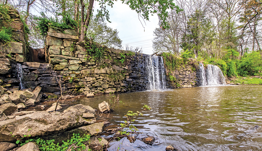
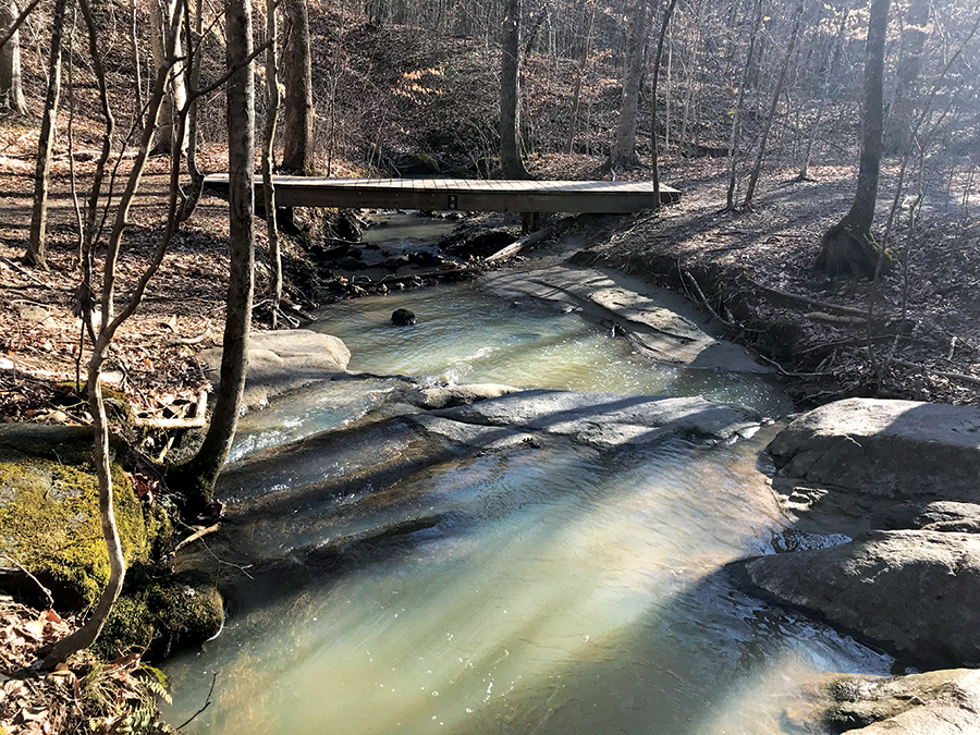
Company Mill Preserve
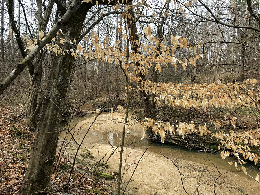
My friend Ashley, who’d just moved back to Greensboro (and, yes, happens to also be the editor of this magazine), mentioned that she’s sick and tired of Zoom meetings and deadlines. I know just the remedy, I told her: a few minutes of soaking in the sounds of Big Alamance Creek where it cascades over the historic and hand-stacked Company Mill dam. After lolling around on an observation pier jutting out into the mill pond, we trade stories about our childhood encounters with cattails. But I’m eager to show her the towering oaks less than a mile from the parking lot. We launch out onto the trail, which follows a crooked creek through a lush marsh vibrant with newly hatched aquatic plants. Little birds flitter through the underbrush. Serenaded by a chorus of frogs, we ascend the ridge line into the shady majesty of a mature hardwood forest. We stroll past rocky outcrops, adjacent pastureland and spots that offer vistas of farmland and McMansions in the distance. Midway along the trail, a rustic, two-story nineteenth-century log homestead emerges from the woods. Then a pair of abandoned tobacco barns. Hopping over rocks to cross the creek (I understand there’s a bridge now), we end up at Hagan-Stone Park, where we turn around after checking out a restored log cabin — and, yes, rest rooms. Hiking this trail is a little like taking a trip back into North Carolina’s rural history, we decide, but without Zoom meetings.
Length: Less than six miles out and back
Difficulty: Moderate with a fair amount of up and down
Don’t miss: There are several loop trails and spurs if you want to extend your walk in the woods
Good to know: The trail can be muddy, even impassible in places if you’re picky about getting your feet wet. Ashley retired a pair of flats and will be bringing her trail boots next time.
Address: 6344 Company Mill Rd., Climax
Rich Fork Preserve
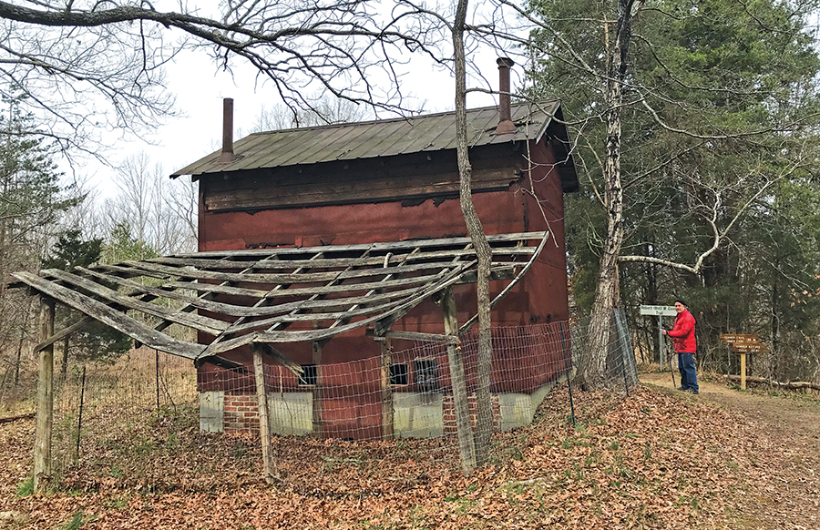
After struggling through the maze of congestion on High Point’s North Main Street, my friend Chip and I breathe a sigh of relief as we take a left onto the residential calm of Parris Avenue. In less than a mile, we come to the gates of Rich Fork Preserve, where we’re greeted by a hooting owl as soon as the car door opens. Chip, whose knees seem, to him, a decade older than he is, is relieved to see a half-mile jaunt outlined on the map. “This was someone’s farm,” he says as we hit the trail, looking at a modest residence. “And those are probably tobacco barns.” Our short walk in the woods is shadowed by poplars sawing in the winds and, here and there, majestic oaks. We stay on a high bluff, overlooking the ripples of a creek snaking though a ravine. Old roads crisscross the trail, and abandoned fence posts and perhaps a dozen buildings punctuate our trek. “It’s the old Hedgecock farmstead,” I tell him. “A website says it’s ‘a piece of land trapped in time. The world around it developed while it stayed still.’” “Works for both me and my knees,” Chip says.
Length: A country mile or so if you take the Conner Trail out and back and the loop
Difficulty: Easy-peasy unless you take the downhill loop, but Chip made it down and back up
Don’t miss: Starbucks on the way in or out or both
Good to know: There are several miles of trails and loops on the adjacent hike-and-bike trail
Address: 407 W. Parris Ave., High Point

Guilford County Farm
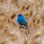
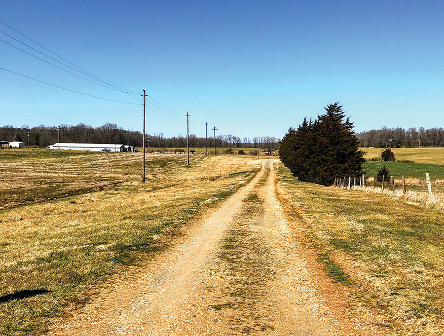
For me, a hike is a trek of 8-10 miles with a vertical gain of 1,200 feet or more as measured by my Gaia GPS app. My wife, Anne, loves nature but, for her, hiking is what my father called dawdling. Birdwatching, she calls it. One of the few places that suits us both is the Guilford County (former) Prison Farm. When I drop her off about a third of a mile down Breakaway Trail, the sky is storybook blue. When I go back to park the car in the lot, a woodpecker, red-bellied or red-headed (where’s Anne?), glides high above me as a motley chorus of songbirds erupt in a mash-up of jubilant timbres. Starlings (or are they blackbirds?) mob the vineyard across the road. Crows (or maybe they’re ravens) heckle me from their perches as I hike back down Howerton Road. On one side of the trail is a creek bottom aflutter with wings; on the other side, open agricultural fields. That’s the charm of this place: The largest of the county’s preserves, you can “run a fence line” through its bucolic rolling hills — just one of the reasons it’s on N.C.’s Mountain-to-Sea Trail. Panting, I pass a line of cedars that is surely bristling with cedar waxwings (I think) and catch up with Anne. “Seen any birds?” I ask. “The only bird I’ve seen is a red-tailed hawk, but I saw a dozen deer running along the creek bottom,” she says. I don’t say a word.
Length: 2.2 miles out and back on the Breakaway Trail, which connects to a 1.8-mile loop
Difficulty: Easy and flat. There’s a loop trail that’s more up and down
Don’t miss: The 1935 stone-built prison dorm next to the parking lot
Good to know: If you’d rather walk in the woods, find access to the loop trail at the lake on Amick Road (Howerton Road becomes Amick Road as you go into Alamance County just past the Prison Farm)
Address: 7315 Howerton Road, Elon